


Footing autour du Gesvres

topolino
User

Length
7.6 km

Max alt
40 m

Uphill gradient
105 m
Km-Effort
9 km

Min alt
9 m

Downhill gradient
105 m
Boucle
Yes
Creation date :
2023-02-15 18:40:55.364
Updated on :
2023-02-15 18:42:54.445
0m
Difficulty : Easy

FREE GPS app for hiking
 SityTrail
IGN / Geographical institutes
SityTrail Plus
The world is yours!
About
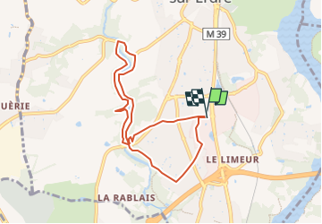
Trail Running of 7.6 km to be discovered at Pays de la Loire, Loire-Atlantique, La Chapelle-sur-Erdre. This trail is proposed by topolino.
Positioning
Country:
France
Region :
Pays de la Loire
Department/Province :
Loire-Atlantique
Municipality :
La Chapelle-sur-Erdre
Location:
Unknown
Start:(Dec)
Start:(UTM)
609590 ; 5237622 (30T) N.
Comments